Update, 21 September: This account has been superseded. Red warnings have since doubled to six districts and five rivers have reached flood levels — and Ruwanwella and Bulathkohupitiya, the divisions this report noted carried no warning when a man died there, now both appear on the Level 2 list.
A man has died at Ruwanwella in Kegalle after an embankment collapsed beneath him and swept him into the overflowing Ritigaha Oya — the first confirmed death of this weather episode.
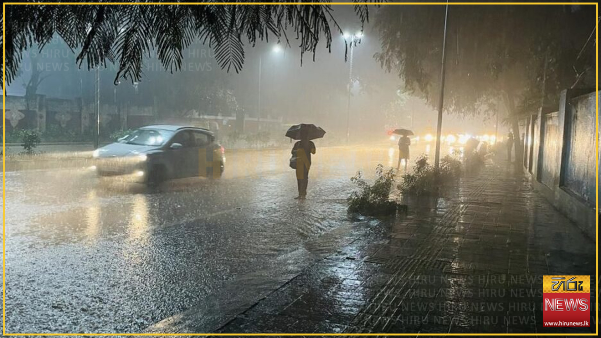
The National Building Research Organisation (NBRO) has raised its landslide warnings to Level 3 (Red) — the highest tier, which carries an instruction to evacuate — across divisions in Kandy, Kegalle and Nuwara Eliya, capping a day of continuous escalation on the western slopes of the central hills.
The warnings are no longer precautionary. An earthslip has closed the Hatton–Bogawantalawa road, the first confirmed landslide of the episode, and the Wimalasurendra reservoir has spilled. By Sunday evening Nawalapitiya had recorded 210 mm of rain in 24 hours, the island’s highest.
Six river basins are rising, the Kandy District Secretariat has instructed officials to prepare designated safe centres, and the Education Ministry has handed the decision on whether to open schools on Monday to provincial and zonal officials — in the worst-hit zones, down to individual principals.
A man has died at Ruwanwella — in a division under no warning at all
A resident of the Ampagala area died on Sunday after an embankment collapsed and swept him into the Ritigaha Oya, which was overflowing after heavy rain, Hiru News reported, citing Ruwanwella Police.
The collapse happened near Polkatu Wanguwa on the Ruwanwella–Bulathkohupitiya road. Police said the man was standing on the embankment when the earth mound suddenly caved in beneath him. His body was recovered after a search by local residents and police.
The death did not occur in any division the NBRO had warned. Ruwanwella appears nowhere in Sunday’s bulletin — not in the Level 3 Red list for Kegalle (Dehiowita, Aranayaka, Deraniyagala, Mawanella, Yatiyanthota), not in the Level 2 Amber list (Dehiowita, Yatiyanthota), and not in the Level 1 Yellow list (Deraniyagala). Neither does Bulathkohupitiya, at the other end of the road.
That is not a failure of the landslide warnings so much as a limit on what they cover. This was a riverbank collapse into a swollen watercourse, not a hillside failure of the kind the NBRO’s tiers are built around, and the Ritigaha Oya is not among the six basins the Irrigation Department has been reporting on. The hazard that killed him was being monitored by nobody — and the same combination of saturated ground and rising water exists along watercourses across the warned districts.
Ada Derana also carried the death; its site was unreachable for verification at the time of writing, so it is not cited here.
The day in sequence
| Time | Escalation |
|---|---|
| 8.11 a.m. | Met Department forecasts falls above 100 mm |
| 9.21 a.m. | NBRO landslide warnings, six districts |
| 9.41 a.m. | Mahaweli minor flood warning, Pasbage Korale |
| 10.00 a.m. | NBRO widens to eight districts, Level 2 Amber |
| 11.00 a.m. | Earthslip blocks the Hatton–Bogawantalawa road |
| 11.16 a.m. | Kuda Ganga and Magura Ganga at spill level, Kalutara |
| 12.10 p.m. | Kandy warned of possible flooding; safe centres readied |
| 12.16 p.m. | Six river basins reported rising |
| ~2.00 p.m. | NBRO issues Level 3 Red evacuation warnings |
| 4.14 p.m. | Met Department: heavy rain to continue another 36 hours |
| 6.00 p.m. | Nawalapitiya’s 24-hour total reaches 210 mm, the island’s highest |
| evening | A man is swept to his death in the Ritigaha Oya at Ruwanwella |
| evening | Education Ministry delegates Monday’s school-opening decision to Provincial Directors |
| 8.29 p.m. | Nuwara Eliya and Hatton zones push that decision down again, to principals |
The rain has another 36 hours to run — and it outlasts the warning
In its general forecast issued at 4.00 p.m. on Sunday, the Meteorological Department said heavy rainfall exceeding 100 mm, thundershowers and strong winds are expected in several parts of the country during the next 36 hours, the Daily Mirror reported.
That window runs to roughly 4.00 a.m. on Tuesday — about 18 hours beyond the expiry of the NBRO’s landslide warnings at 10.00 a.m. Monday. The rain driving the alerts is forecast to continue well after the alerts themselves lapse. Neither the Met Department nor the NBRO addresses the mismatch.
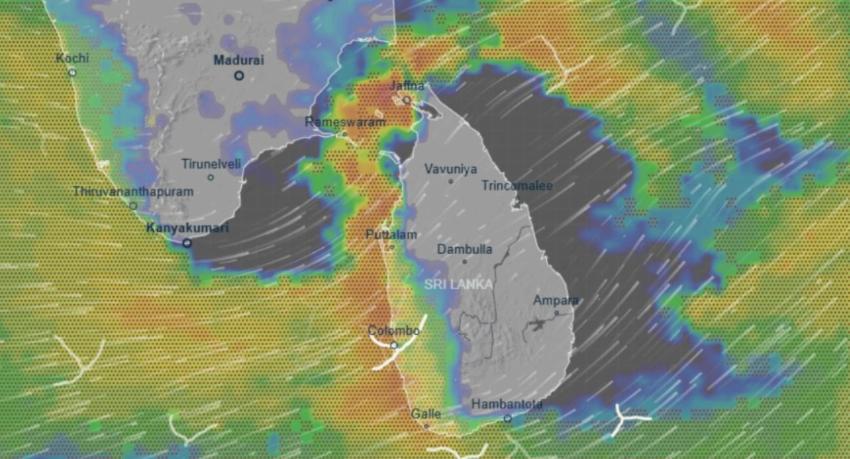
Showers or thundershowers are expected at times in the Western, Sabaragamuwa and North Western provinces and in Galle, Matara, Kandy and Nuwara Eliya districts, with falls above 100 mm likely at some locations. Several spells of showers may occur in the North Central Province and Mannar, and showers or thundershowers at several places in Uva Province and Batticaloa and Ampara districts after 2 p.m. Fairly strong winds of 30–40 kmph are expected at times over the western slopes of the Central Hills, the North Central and North Western provinces, and in Trincomalee, Hambantota and Matale.
The cause has finally been explained
This filing settles a question that has hung over the episode since Friday. Reporting on 18 September attributed the south-west rain to a low-pressure area near the Andaman Islands; the Daily Mirror on Sunday morning attributed it instead to the active Southwest Monsoon, with no outlet acknowledging the change.
The 4 p.m. forecast reconciles both. A low-pressure area has formed over the Bay of Bengal, north-east of Sri Lanka in the vicinity of the Andaman region — but the department says it is not expected to have a direct impact on Sri Lanka. Rainy conditions in the south-west are continuing because of wind flow towards that system, not because the low is crossing the island.
The two attributions were therefore describing the same weather from different ends: the low is real and is driving the rain, but indirectly, by dragging moist air across the south-west. The Met Department’s own phrasing is the first public statement of that mechanism.
The public has been advised to take precautions against damage from temporary localised strong winds and lightning during thundershowers.
Level 3 Red: the evacuation tier
The NBRO issued Level 3 (Red) landslide early warnings on Sunday afternoon, Hiru News reported. Level 3 is the top of the NBRO’s three-tier scale and directs residents in vulnerable locations to evacuate, rather than merely to prepare to.
The two outlets covering it do not agree on how many districts it covers, and each supplies divisions the other omits.
NewsFirst reported the Red warning as covering two districts:
- Kandy: Pasbage Korale
- Nuwara Eliya: Kotmale West, Kotmale East, Ambagamuwa, Norwood
Hiru’s headline names three districts — Kandy, Kegalle and Nuwara Eliya — and its body lists:
- Kegalle: Dehiowita, Aranayaka, Deraniyagala, Mawanella, Yatiyanthota
- Nuwara Eliya: Kothmale West, Kothmale East, Ambagamuwa, Norwood
Hiru names Kandy in its headline but lists no Kandy division; NewsFirst names the Kandy division but omits Kegalle entirely. Taken together the two filings give Pasbage Korale in Kandy, five divisions in Kegalle, and four in Nuwara Eliya — but no single outlet publishes that combined list, and neither acknowledges the other’s coverage. Readers in Kegalle relying on NewsFirst alone would not know a Red warning applies to them.
NewsFirst frames the instruction conditionally — residents are advised to evacuate “if the rain persists”.
Aranayaka, in the Kegalle Red list, was the site of Sri Lanka’s deadliest recorded landslide, in May 2016. The NBRO last placed Kegalle and Ratnapura divisions under Level 3 Red in late May this year, when the monsoon’s first fatality was reported.
An earthslip has already closed a main road
A large mound of earth collapsed onto the Hatton–Bogawantalawa road at Wanaraja Estate in Dikoya at around 11.00 a.m., bringing traffic to a complete standstill, Hiru News reported.
Officers from Hatton Police and local residents began clearance work, and the Road Development Authority was notified. Hatton Police warned that a risk of further earthfalls remains and asked motorists to exercise extreme caution.
The Daily Mirror, filing at 1.43 p.m., describes the same route as the Hatton–Bagawantalawa–Maskeliya–Balangoda road, making clear this is not a minor link but a corridor connecting the hill-country plantation towns to Balangoda and the south.
Dikoya sits in the Ambagamuwa divisional secretariat division — one of the four Nuwara Eliya divisions later placed under the Level 3 Red warning. The slope failure happened roughly three hours before the Red alert was issued for the area it occurred in.
A naming note: Hiru writes “Bogawantalawa” and “Wanaraja”; the Daily Mirror writes “Bagawantalawa” and “Wanraja”. Same road, same estate.
A reservoir has spilled, and a second river basin was added
Heavy rain on the western slopes since Saturday night triggered the spilling of the Wimalasurendra reservoir early on Sunday morning, Hiru News reported. Reservoir engineers said water levels in the Kelani River rose slightly following the overflow, and that Maussakelle and Castlereagh are also nearing spill level.
That is a change from the morning position, when Maussakelle and Castlereagh were described as approaching spill and no reservoir had actually overflowed.
Separately, the Kuda Ganga and Magura Ganga in Kalutara reached spill level earlier in the day.
The heaviest rain fell on the divisions ordered to evacuate
The island’s highest rainfall in the 24 hours to 6.00 p.m. on Sunday was recorded at Nawalapitiya in the Kandy District — 210 mm, according to the Disaster Management Centre, Hiru News reported. The DMC said the Kothmale and Ambagamuwa divisional secretariat divisions in Nuwara Eliya recorded 185 mm over the same period.
That figure supersedes the morning’s island maximum of 132.5 mm at Udugama in Galle — but the two are not in conflict. They are different 24-hour windows: Udugama’s closed on Sunday morning, Nawalapitiya’s at 6 p.m., capturing the day’s heaviest falls. The island maximum has risen by 77.5 mm between the two readings, and the centre of the rain has moved from the southern coast to the central hills.
Kothmale and Ambagamuwa are both on the Level 3 Red list — the divisions where residents have been told to evacuate. The DMC’s second-highest reading fell directly on them. Nawalapitiya itself sits in Kandy District, whose only Red-warned division is Pasbage Korale, and is on the stretch of the Mahaweli already under a major flood warning.
Neither the DMC nor the NBRO connects the two datasets publicly. Read together, they say the rain was heaviest exactly where the evacuation orders are.
Schools: the decision has been pushed down two levels
The Ministry of Education has delegated the decision on whether to open schools on Monday (21) in districts affected by the weather to Provincial Directors of Education, Hiru News reported.
In the two worst-affected zones, that authority was then delegated again. Principals in the Nuwara Eliya and Hatton education zones have themselves been given the decision, the Daily Mirror reported at 8.29 p.m. Nuwara Eliya Zonal Education Director D.M.S.B. Dissanayake said principals had been instructed to assess conditions in their own areas, decide, and inform the Zonal Education Office of what they decided.
The two filings are not in conflict — they are consecutive links in one chain. Ministry → Provincial Directors → Zonal Directors → principals. Hiru has the national instruction; the Daily Mirror has where it ended up in the hills. Neither outlet mentions the other’s step, so neither alone shows that the call now rests with individual schools.
The practical effect is that there is no islandwide closure and no single announcement to look for. Parents in Nuwara Eliya and Hatton must check with their own school. The devolution also means no central record of which schools closed — and it places the judgement on principals in precisely the divisions under Level 3 Red, where the instruction to residents is to evacuate.
Nawalapitiya, Kothmale and Ambagamuwa — the three locations with the day’s heaviest recorded rainfall — all fall inside the zones now deciding school by school.
The warning was both widened and extended
The new NBRO warnings run from 10.00 a.m. on Sunday (20) until 10.00 a.m. on Monday (21), Hiru News reported.
That is a change on two counts. The morning bulletin covered six districts and expired at 7.00 a.m. on Monday. The replacement covers eight and runs three hours longer. The two districts added are Matara and Colombo, neither of which appeared in the earlier list of Galle, Kalutara, Kandy, Kegalle, Nuwara Eliya and Ratnapura. No outlet notes the expansion; it is visible only by comparing the two lists.
Level 2 (Amber) alerts — the higher of the two tiers issued — cover:
- Kandy: Pasbage Korale
- Kegalle: Dehiowita, Yatiyanthota
- Matara: Pitabeddara
- Nuwara Eliya: Kotmale, Ambagamuwa, Norwood
- Ratnapura: Ratnapura, Eheliyagoda
Residents in those divisions are advised to stay on high alert for landslides, slope failures, rockfalls and ground subsidence, and to be prepared to evacuate to safe locations if needed. That is the first evacuation language of the day; the morning bulletin carried none.
Level 1 (Yellow) warnings cover Seethawaka (Colombo); Nagoda and Neluwa (Galle); Palindanuwara and Bulathsinhala (Kalutara); Ganga Ihala Korale (Kandy); Deraniyagala (Kegalle); Kotapola (Matara); and Ratnapura, Kalawana, Ayagama, Pelmadulla, Kuruwita and Elapatha (Ratnapura).
The NBRO urged people living near mountain slopes, man-made cut slopes and previously identified landslide-prone locations to watch for ground cracks, slanting trees and utility poles, and sudden mudflows.
Two divisions now carry two warnings at once
The most consequential detail is one no outlet states, and it emerges only by laying the landslide list against the flood list.
Pasbage Korale in Kandy holds a Level 2 Amber landslide alert and the major flood warning simultaneously. It is the only division in the country under both the higher landslide tier and a major flood warning.
Bulathsinhala and Palindanuwara in Kalutara are in the same position one tier down: both sit under Level 1 Yellow landslide warnings and inside the Kuda Ganga flood-warning zone.
The Mahaweli warning has been upgraded
The Irrigation Department now warns of a major flood risk in low-lying areas around the Mahaweli River in the Pasbage Korale Divisional Secretariat Division, following heavy rainfall in the upper catchment over the past few hours, Hiru News reported.
This is the same location the department described as a minor risk earlier in the day. Residents and motorists using roads through the area have been asked to exercise extreme caution, and disaster management units have been requested to initiate all required actions.
The Daily Mirror carried the warning at 9.41 a.m., adding that disaster management authorities and emergency response units had been alerted and instructed to coordinate relief operations. The Daily Mirror’s version does not use the word “major” — the upgrade appears in Hiru’s later filing. Neither outlet acknowledges that the classification changed.
The Mahaweli warning zone has widened from one division to eight
By 2.34 p.m. the Irrigation Department’s Mahaweli minor flood warning no longer covered Pasbage Korale alone. NewsFirst reported it as covering eight divisional secretariat divisions: Ganga Ihala Korale, Udapalatha, Doluwa, Udunuwara, Yatinuwara, Gangawata Korale, Harispattuwa and Pathadumbara — an arc running from the upper catchment down through the Kandy valley.
A third basin: the Gin River
NewsFirst’s filing also adds a river basin that appeared in none of the morning’s warnings. Low-lying areas in Thawalama, Nagoda, Baddegama and Welivitiya-Divithura are under a minor flood warning along the Gin River, valid for 24 hours, after significant rainfall in its catchment.
That matters because the Gin’s catchment is where the day’s heaviest rain actually fell — Udugama, Batuwangala and Dellawa all sit in the Galle hinterland the Gin drains.
Kandy has been told to prepare safe centres
The Kandy District Secretariat has warned residents of Gelioya, Gampola, Nawalapitiya and Peradeniya to stay alert to the possibility of flooding as Mahaweli levels continue to rise, the Daily Mirror reported at 12.10 p.m.
Divisional Secretaries and police have been asked to take measures to ensure residents’ safety, and to direct people to designated safe centres where necessary depending on how the situation develops. The notice was issued by I.A.K. Ranaweera, Deputy Director (Disaster Management), on behalf of the Kandy District Secretary.
This is the first time on Sunday that named towns, rather than divisional secretariat divisions, were placed on notice, and the first mention of safe centres anywhere in the day’s reporting.
Six river basins are rising, and one is at a level of particular concern
The broadest picture of the day came from the Irrigation Department’s Water Management Unit. Eng. L.S. Suriyabandara, its Director, said water levels in several major rivers had risen significantly, particularly along their middle and downstream reaches, NewsFirst reported at 12.16 p.m.
The basins named are the Nilwala, Gin, Bentara, Kalu and Kelani rivers and the Attanagalu Oya. Suriyabandara said the Attanagalu Oya has already reached a level of particular concern, and that the Maguru Oya, a tributary of the Kalu, has reached flood warning level. Areas along the middle reaches of the Kalu — Ellagawa and Putupaula — and surrounding low-lying land face heightened flood risk.
Set against the formal warnings, this is the day’s most significant underreported fact. Formal flood warnings have been issued for three basins — the Mahaweli, the Gin, and the Kuda Ganga/Magura Ganga in Kalutara. Suriyabandara names six basins plus a tributary as rising. The Nilwala, Bentara, Kelani and Attanagalu Oya are rising without a corresponding public warning, and the Attanagalu Oya — which drains into the Gampaha district north of Colombo — is singled out as the most concerning of them while carrying no warning at all.
A second basin, and two reservoirs near spill
Separately, the Irrigation Department warned of a minor flood risk over the next 24 hours in low-lying areas around the Kuda Ganga and Magura Ganga in the Bulathsinhala, Madurawala and Palindanuwara divisions of Kalutara, as both rivers reach spill level, Hiru News reported. By-roads in low-lying areas near the rivers are at high risk of being inundated.
NewsFirst independently reported the same warning at 11.16 a.m., naming the same three divisions.
Hiru adds a fact that appears nowhere else: reservoir engineers report that Maussakelle and Castlereagh are approaching spill level after heavy rain on the western slopes of the central hills since last night. Both reservoirs sit in the upper catchment above Norwood and Ambagamuwa — two of the divisions now under Level 2 Amber alert.
The rainfall figures, station by station
NewsFirst’s filing answers a question none of the morning reports did: where the rain actually fell.
| Station | District | Rainfall |
|---|---|---|
| Maliboda | Kegalle | 103.5 mm |
| Delwala Tea Factory | Galle | 93.5 mm |
| Gurudiyapoththa Tea Factory | — | 87.5 mm |
| Neboda | Kalutara | 83.0 mm |
The 103.5 mm figure is the same number the Daily Mirror gave earlier for Kegalle District over the 24 hours ending at 6.00 a.m. NewsFirst attributes it to the Maliboda gauge specifically and describes it as falling “over the past several hours.” The two are almost certainly the same reading described at different levels of precision, rather than two separate 103.5 mm falls — but no outlet reconciles them, and readers should not add them together.
Udugama’s 132.5 mm supersedes all of it
Those figures were overtaken later in the day. Galle’s Udugama recorded 132.5 mm in the 24 hours ending at 8.30 a.m. on Sunday — the highest in the island, Hiru News reported, citing the Department of Meteorology. Batuwangala and the Dellawa tea factory area in the Neluwa divisional secretariat division each recorded 126.5 mm.
| Station | District | Rainfall | Window |
|---|---|---|---|
| Udugama | Galle | 132.5 mm | 24h to 8.30 a.m. |
| Batuwangala | Galle | 126.5 mm | 24h to 8.30 a.m. |
| Dellawa Tea Factory (Neluwa) | Galle | 126.5 mm | 24h to 8.30 a.m. |
| Maliboda | Kegalle | 103.5 mm | 24h to 6.00 a.m. |
Two cautions. The measurement windows differ — the Hiru figures run to 8.30 a.m., the Kegalle figure to 6.00 a.m. — so the tables are not strictly comparable.
And NewsFirst’s “Delwala Tea Factory, Galle, 93.5 mm” and Hiru’s “Dellawa tea factory, Neluwa, 126.5 mm” are likely the same gauge with a 33 mm discrepancy, reported under two spellings across two windows two and a half hours apart. Neither outlet mentions the other’s figure. The safest reading is that the Dellawa gauge accumulated a further ~33 mm between the two cut-offs, but that is inference, not reporting.
The day’s rainfall centre of gravity was therefore not in the districts under the Red landslide alert. The three heaviest gauges are all in Galle, which carries only a Level 1 Yellow landslide warning — while the Red warnings sit over Kandy, Kegalle and Nuwara Eliya, where the slopes are steeper.
NewsFirst has also revised its own advisory. Its morning version placed Galle and Matara only under “showers at times”; its 11.16 a.m. version lists Kandy, Nuwara Eliya, Galle and Matara alongside the Western and Sabaragamuwa provinces, and says heavy falls above 100 mm are likely at some places in these areas. That resolves, in the Daily Mirror’s favour, the discrepancy flagged in this article earlier in the day.
A naming note
Hiru’s headline and copy render the agency as the “National Building Research Institute.” The organisation’s name is the National Building Research Organisation, as used by the Daily Mirror and in the agency’s own bulletins. The two refer to the same body.
Hiru’s Level 1 list also repeats the Ratnapura divisional secretariat division, which already appears under Level 2. It is not clear from the filing whether that division carries both tiers or whether the repetition is an error.
What has been answered since this morning
Three of the questions this article left open earlier on Sunday now have answers, and all three moved in the same direction.
Has a landslide actually occurred? Yes — the Hatton–Bogawantalawa earthslip at 11.00 a.m., with a warning that more may follow. Has a road been closed? Yes, that one, completely. Has an evacuation been ordered rather than prepared for? Effectively — the Level 3 Red tier directs evacuation, conditioned by NewsFirst on the rain persisting, and Kandy has been told to ready safe centres.
Still not reported
No outlet reports any injury or death, how many households sit inside the Red warning divisions, or how many people have actually moved to safe centres. None gives a figure for how many are inside the eight warning districts.
For the Hatton earthslip: no estimate of the volume of earth, no expected time for the road to reopen, no diversion route, and no word on whether any vehicle or person was caught in it. Whether any property was damaged is not stated.
The most consequential gap is the four rising basins with no public warning — the Nilwala, Bentara, Kelani and Attanagalu Oya. No outlet asks the Irrigation Department why the Attanagalu Oya is described as being at a level of particular concern while carrying no formal warning, or what level would trigger one.
Also unstated: what river level triggered the Mahaweli change from minor to major; spill volumes or gauge heights for any basin; how much Wimalasurendra is discharging and what that means downstream on the Kelani; what happens if Maussakelle and Castlereagh spill, and which areas would be affected; and whether schools will open on Monday in the warning districts.
It is not stated whether the landslide warnings will be extended again past 10.00 a.m. Monday, nor whether the Red tier will be widened, downgraded or allowed to lapse — a question the 4 p.m. forecast makes sharper, since the rain is now projected to run about 18 hours beyond the warnings’ expiry.
On the Andaman low, it remains unstated whether the system is expected to deepen, in which direction it is tracking, and whether a direct impact is possible later in the week.
Sources
- NBRI issues Level 3 Red landslide warnings for Kandy, Kegalle and Nuwara Eliya — Hiru News, September 20
- Extreme Weather: Landslide Red Alert Issued in Kandy, Nuwara Eliya — NewsFirst, September 20
- Hatton-Bogawantalawa main road blocked by earthslip following heavy rains — Hiru News, September 20
- Landslide blocks Hatton-Bagawantalawa Road — Daily Mirror, September 20
- Udugama records highest rainfall of 132.5 mm as active monsoon triggers heavy showers — Hiru News, September 20
- Minor Flood Warnings Issued Along Mahaweli, Gin Rivers — NewsFirst, September 20
- Mahaweli River Water Levels Rise; Minor Flood Warning Issued — NewsFirst, September 20
- Mahaweli River water levels rise; Kandy areas warned of possible floods — Daily Mirror, September 20
- NBRI issues landslide early warnings for eight districts — Hiru News, September 20
- Major flood warning issued for Mahaweli River low-lying areas in Pasbage Korale — Hiru News, September 20
- Flood warning issued for low-lying areas along Mahaweli River — Daily Mirror, September 20
- Minor flood warning issued for low-lying areas in Kalutara district — Hiru News, September 20
- Extreme Weather: Heavy Rainfall Triggers Minor Flood Risk in Several DS Divisions — NewsFirst, September 20
- Heavy rainfall above 100mm expected in several areas — NewsFirst, September 20
- Heavy rain forecast for next 36 hours — Daily Mirror, September 20
- Heavy rains exceeding 100 mm forecast in several areas — Daily Mirror, September 20
- Landslide warnings issued for six districts — Daily Mirror, September 20
- Heavy rain over 100 mm expected today in several areas — Hiru News, September 20
- Minor flood risk along low-lying areas of Mahaweli River in Pasbage Korale — Hiru News, September 20