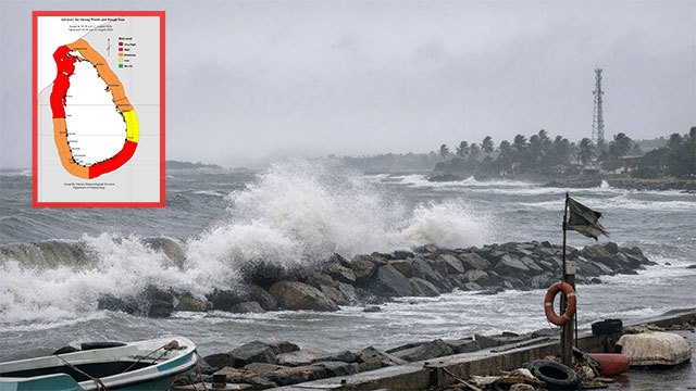
The Department of Meteorology has issued an “Amber” advisory for strong winds and rough seas across several coastal stretches, Ada Derana reported on Friday.
The advisory covers the sea areas off the coast extending from Kankesanturai to Chilaw via Mannar, and from Matara to Pottuvil via Hambantota.
What the advisory forecasts
Those sea areas will be rough at times, with strong gusty winds of up to 50 to 60 kilometres per hour, according to the department.
Wave heights may rise to about 2.5 to 3.0 metres in the sea areas off the coast extending from Negombo to Pottuvil via Galle and Matara — a stretch that runs down the west coast and around the southern tip of the island.
Naval and fishing communities have been asked to remain vigilant.
Amber in the Met Department’s scale
An Amber advisory sits below the department’s Red warning and signals conditions that could be dangerous to small craft and inshore operations rather than a general emergency. Advisories of this kind are issued frequently during the southwest monsoon period and are typically reviewed and reissued as conditions change.
The department issued a similar Amber advisory for strong winds and rough seas on August 14, and a separate advisory for high waves between Negombo and Pottuvil on August 18.
Friday’s advisory concerns wind and sea conditions and is distinct from the dry weather affecting 81,765 people across seven districts, which relates to rainfall deficit inland.
No other verified newsroom had carried the advisory as of Friday evening.
Update: advisory reissued for Saturday, August 22
The Department of Meteorology issued the Amber advisory again on Saturday, keeping the same wind areas and the same 50 to 60 kmph gust range.
The wind warning again covers the sea areas off the coast from Kankesanturai to Chilaw via Mannar, and from Matara to Pottuvil via Hambantota.
The wave-height zone was extended northwards. Where Friday’s advisory put waves of 2.5 to 3.0 metres between Negombo and Pottuvil via Galle and Matara, Saturday’s runs from Puttalam to Pottuvil via Colombo, Galle and Matara — adding the stretch of west coast above the capital.
Naval and fishing communities were again asked to remain vigilant.
Update: advisory reissued for Sunday, August 23, with easing seas
The Department of Meteorology issued the Amber advisory for a third consecutive day on Sunday, keeping the same 50 to 60 kmph gust range but scaling back both the wind area and the expected wave heights.
The wind warning now covers the sea areas from Kankasanthurai to Chilaw via Mannar, and from Hambantota to Pottuvil. The southern leg has been shortened: Friday’s and Saturday’s advisories ran from Matara to Pottuvil via Hambantota, so the stretch between Matara and Hambantota is no longer included.
Forecast wave heights have also come down. Where Saturday’s advisory put waves at 2.5 to 3.0 metres, Sunday’s gives 2.0 to 2.5 metres — over the same zone from Puttalam to Pottuvil via Colombo, Galle and Matara.
Naval and fishing communities were again asked to remain vigilant. Taken together, the shorter wind area and lower wave range point to gradually easing conditions rather than a worsening system.